Word from the Ground about the View from the Sky
December 18, 2014
Ice Stupa Site on the Ground and from the Sky
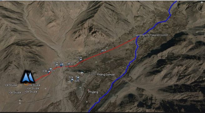
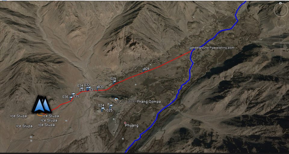
The 2.5 km trench for the Ice Stupa pipeline has now been complete for more than a week. The only thing holding us back is the PVC pipes supplied by Arotek Industries Jammu. Apart from delays, roughly 18% of the pipes broke in transport. We have requested the company to supply replacements, but they have been behaving strangely even as the Leh- Srinagar road is about to close. We are now considering legal action against the company.
Meanwhile on the brighter side, our Ladakhi Ice Stupa volunteer Stanzin Passang Jingmal has done a great job of mapping the whole path of the pipeline that you see in the real photograph with GPS, and then he superimposed it on GoogleEarth. This way he is able to show the location of various parts of the Ice Stupa on a satellite sky-view of Phyang valley. You can even see the glaciel source of the Phyang Tokpo stream.
Passang - who has been doing mapping work on various projects like the map of Leh, eco-map of Pangong lake area, etc. - is keen to do higher studies in geography. He is going to Germany this winter to do his PhD on snow cover and glaciers in Ladakh. We wish him a bright future.
We will soon post a link to his work on GoogleEarth itself, so you can explore the whole valley, but for now you can enjoy the pictures of the same.